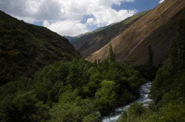
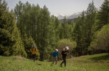
Kyrgyzstan: Ak Suu Transverse Trek Кыргызстан: Ак Суу Трансверсе The Ak Suu Transverse trek is the peak hiking experience in Kyrgyzstan’s Ak-Suu region, starting from the small ecotourism village of Jyrgalan and crossing the whole of Ak-Suu to end at the Soviet-era health resort at Jeti-Oguz, crossing along the way […]
Tag: Central Asia
Kyrgyzstan: Shatyly Panorama
Kyrgyzstan: Shatyly Panorama Кыргызстан: Панорама Шатылы Shatyly Panorama is a short but rewarding viewpoint hike from the Boz-Salkyn Valley (near the town of Bokonbaevo) to an overlook with incredible views of the South Shore of Kyrgyzstan’s Issyk-Kol Lake. Barely even long enough to call it a hike in Kyrgyzstan, we […]
Kyrgyzstan: Ratsek Hut
Kyrgyzstan: Ratsek Hut Кыргызстан: хижина рацека A classic hike for climbers and trekkers in Kyrgyzstan, the trek to Ratsek Hut (хижина рацека in Russian) is for many local mountaineers the first step on holidays to climb the peaks that surround the Ak-Sai Glacier, for which the Ratsek Cabin is a […]
Kyrgyzstan: Chon Kaindy Valley Trail
Kyrgyzstan: Chon Kaindy Valley Kyrgyzstan’s Chon Kaindy Valley (sometimes transliterated as Chong-Kaindy of Chong-Kaingdy instead) is not among the well-known trekking routes in the Chuy Oblast surrounding Bishkek, and therein lies much of the appeal. There are no epic peak panoramas, but an abundance of beautiful verdant nature away from […]
Kyrgyzstan: Ak Suu Arboretum
Kyrgyzstan: Ak Suu Arboretum Dayhike Ak Suu Arboretum is an easy dayhike outside the city of Karakol in the east of Kyrgyzstan. Not very physically demanding and with reasonably pleasant walking and nice views, it makes for a nice rest day in Karakol or a simple dayhike for travellers who […]
Kyrgyzstan: Topographic Trek Maps
Kyrgyzstan Topographic Trekking Maps топографические карты Кыргызстана In partnership with national tourism brand Discover Kyrgyzstan, the USAID Business Growth Initiative recently helped design a set of topographic trekking maps covering their partner destinations across the country of Kyrgyzstan. Each map includes detailed descriptions, distance, and difficulty information along with photos of every […]